|
 Makalu region is an absolutly amazing still very untouched area in the northwestern corner of the Sankhuwasabha district. To the west, it is bordered by the Everest region, to the north by Tibet, to the east by the Arun river and to the south by the Sabha river. It just so happens that this very pristine area was dedicated into a national park and conservation area in the early 1990's. The park is still at its beginning stages. Though struggling to make its mark, it has done fairly well. Unlike the Annapurna Conservation Area Project (ACAP), the Makalu Barun Conservation Project (MBCP) is set up a little differently. It is definitely heading down its own unique path. MBCP is trying, I feel, to develop the area at a rate which is not degrading to any of the systems going on within the park. Tourism seems to be very low on its agenda. The Park hopes to put off that burden as long as possible knowing that it will affect the area drastically if promoted without mediation and direction. But the district of Sankhuwasabha is huge and the park makes up about only one-third of the total area. The region is very close to the Everest region, but drastically different in many ways. Most of the people in this district live in the lower hills with the highest concentrations in the most southern third of the district. A blanket statement could be made that most people live fairly close to the Arun river. The major castes in this area include Gurung, Rai, Tamang, Chetri, Brahmin, Limbu, and Sherpa, almost numerically in that order. Makalu region is an absolutly amazing still very untouched area in the northwestern corner of the Sankhuwasabha district. To the west, it is bordered by the Everest region, to the north by Tibet, to the east by the Arun river and to the south by the Sabha river. It just so happens that this very pristine area was dedicated into a national park and conservation area in the early 1990's. The park is still at its beginning stages. Though struggling to make its mark, it has done fairly well. Unlike the Annapurna Conservation Area Project (ACAP), the Makalu Barun Conservation Project (MBCP) is set up a little differently. It is definitely heading down its own unique path. MBCP is trying, I feel, to develop the area at a rate which is not degrading to any of the systems going on within the park. Tourism seems to be very low on its agenda. The Park hopes to put off that burden as long as possible knowing that it will affect the area drastically if promoted without mediation and direction. But the district of Sankhuwasabha is huge and the park makes up about only one-third of the total area. The region is very close to the Everest region, but drastically different in many ways. Most of the people in this district live in the lower hills with the highest concentrations in the most southern third of the district. A blanket statement could be made that most people live fairly close to the Arun river. The major castes in this area include Gurung, Rai, Tamang, Chetri, Brahmin, Limbu, and Sherpa, almost numerically in that order.
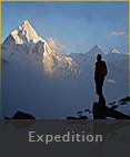
The Makalu trek is still a rough trek that relies for the most part on being self supported from Tashigaon to Makalu (about 10-14 days). This limits the trek to only the most prepared. It is possible to do this trek without hiring a tour operator, but it may make the difference between having a good trek or not. Timing is very important on this trek, as too much snow will make getting over (or returning) the Shipton Pass impossible. Also, it can be miserable if done during the monsoon.
|